Summary
$30
7-day fee
1 live
Camera
Historic Crowd Data
Avg. monthly visitors, 2015–2024 · National Park Service
Light
Moderate
Busy
Very Busy
Peak season is March, when around 17% of annual visitors arrive. For lighter crowds, aim for June–September.
Plan Your Visit
Extreme Heat & Remoteness SafetyDehydration risk▾
Park Entrances & Fees2 entrances · $30▾
North Entrance
Usually Open
Persimmon Gap, via Marathon (US-385)
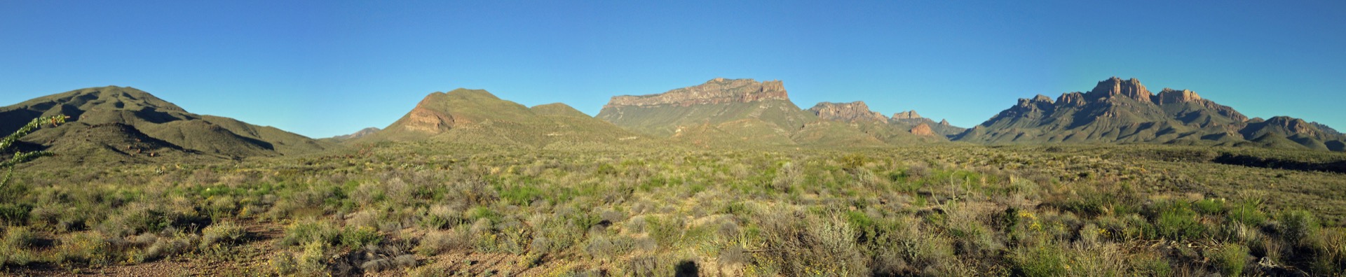
The most common approach, roughly 70 miles south of Marathon through wide open Chihuahuan Desert grassland before reaching Panther Junction.
💡 Long, remote drive with no services — top off gas and water in Marathon before entering.
NPS directions ↗
West Entrance
Usually Open
Study Butte / Terlingua, via FM-170
Approach from the funky desert town of Terlingua — the closest entrance to Santa Elena Canyon and the Ross Maxwell Scenic Drive.
💡 No timed-entry system here, unlike many busier western parks — walk up or drive in any time.
NPS directions ↗
Boquillas CrossingFri–Mon 9am–4pm▾
Campground Availability4 areas▾
Chisos Basin Reservation Only ▾
Sites60 + 7 group
Elevation5,400 ft
NotesThe only campground with meaningfully cooler temps in summer
Book on Recreation.gov ↗
Rio Grande Village Reservation Only ▾
Sites93 + 4 group
ElevationLow, near the river — hot
NotesIncludes 1 ADA site; near Boquillas Canyon
Campground details ↗
Rio Grande Village RV Park Concessionaire ▾
Sites25 full hookup
Max Length38 ft
NotesOperated by Aramark, not on Recreation.gov — call 855-765-1324
Cottonwood Closed for Summer ▾
Sites~30 + 1 group
SeasonClosed ~May–Oct, reopens ~Nov 1
NotesQuiet riverside site near Santa Elena Canyon & Castolon
Campground details ↗
Landmarks & Trailheads8 stops▾
Chisos Basin Area3 stops▾
The Window Trail~3 hrs
Moderate 5.6 mi round trip to a pour-off framing the desert below
Lost Mine Trail~3 hrs
Moderate 4.8 mi round trip, one of the park's best views
Chisos Mountains / Emory Peak7,825 ft
The only US mountain range entirely inside one national park
River Canyons3 stops▾
Santa Elena Canyon~1.5 hrs
Easy trail into the mouth of 1,500-ft limestone canyon walls
Boquillas Canyon~1 hr
Easy trail along the Rio Grande to a towering canyon entrance
Rio Grande Village Nature Trail~30 min
Easy boardwalk loop with river & wetland views
Desert Formations2 stops▾
The Chimneys~2 hrs
Moderate desert hike to volcanic rock formations & petroglyphs
Balanced Rock (Grapevine Hills)~1.5 hrs
Easy 2.2 mi round trip to a boulder balanced between two rock towers
Things to Do7 categories▾
Chisos Mountain Hiking5 trails▾
South RimStrenuous
Big Bend's signature hike, climbing through pine-oak forest to sheer cliffs above the desert floor
12–14.5 mi RT · 2,000 ft gain
Emory PeakStrenuous
Trail to the park's highest point, ending in a short hand-over-hand rock scramble to the 7,825-ft summit
10 mi RT
Boot Canyon TrailStrenuous
High-elevation wooded canyon en route to South Rim; summer nesting habitat for the rare Colima Warbler
3.5 mi one-way
Chisos Basin Loop TrailModerate
Easy loop around the Chisos Basin Trailhead with mountain views
2 mi RT
Window View TrailEasy
Short, paved, wheelchair-accessible overlook of the Window pour-off
0.3 mi RT
Desert Hiking6 trails▾
Marufo Vega TrailStrenuous
Remote desert loop with views into Boquillas Canyon and Mexico
12 mi RT
Mariscal Canyon Rim TrailStrenuous
Overlooks the park's most remote and least-visited river canyon
6.5 mi RT
Mule Ears Spring TrailModerate
Desert walk to a spring beneath the twin Mule Ears rock peaks
3.8 mi RT
Upper Burro Mesa Pour-off TrailModerate
Descends into a dry desert wash below a pour-off cliff
3.8 mi RT · 500 ft gain
Dog CanyonModerate
Cuts through a narrow break in the Dead Horse Mountains
4 mi RT
Chihuahuan Desert Nature TrailEasy
Short self-guided loop identifying common desert plants
0.5 mi RT
River Trips & Hot Spring5 ways▾
Santa Elena Canyon FloatPermit required
Day or overnight trip beneath 1,500-ft limestone walls; easy access and striking scenery
Boquillas Canyon Float33 mi · 3-day trip
A great introductory float trip for visitors with less river experience
Mariscal Canyon Float10 mi · Multi-day
Shortest canyon run, with lots of scenery and a little excitement
The Lower Canyons5–10 day trip
Remote, varied float through open desert and deep canyon country
Langford Hot SpringEasy
105°F spring at the ruins of a historic bathhouse on the Rio Grande; soaking only — no soap, glass, or alcohol
0.5 mi RT
Horseback & Stock Use4 rules▾
Backcountry Stock PermitFree permit
Required for all stock use; obtained in person up to 24 hrs ahead, with current livestock vaccination records
Chisos Mountain TrailsRestricted routes
Horses limited to Laguna Meadow, South Rim & Blue Creek; prohibited on Santa Elena Canyon, Boquillas Canyon & Pine Canyon trails
Hannold Draw CorralReserve on Recreation.gov
The park's only stock corral, holding up to 8 head, 4.8 mi north of Panther Junction
Bring Your Own StockNo outfitters
No horses or pack animals for hire in or near the park
Scenic Drives & Biking4 routes▾
Ross Maxwell Scenic Drive30 mi paved
Paved road past Sotol Vista, Mule Ears & Tuff Canyon to Castolon and Santa Elena Canyon
Old Maverick Road14 mi dirt
Improved dirt road through the Terlingua Creek badlands to Santa Elena Canyon
Panther Junction – Rio Grande Village (bike)20 mi · 1.5–2.5 hrs
The easiest paved shuttle ride in the park; e-bikes allowed on all roads, no trails
Old Ore Road (bike)Strenuous
Unpaved backcountry route through remote desert
26 mi
Bird Watching3 highlights▾
450+ Species Documented450+ species
One of the most bird-diverse national parks in the US; only 56 species reside year-round
Colima WarblerBoot Canyon area
Rarely seen elsewhere in the US; nests in the high Chisos country each summer
Prime Birding SpotsYear-round
Cottonwood Campground, Rio Grande Village Nature Trail & Santa Elena Canyon
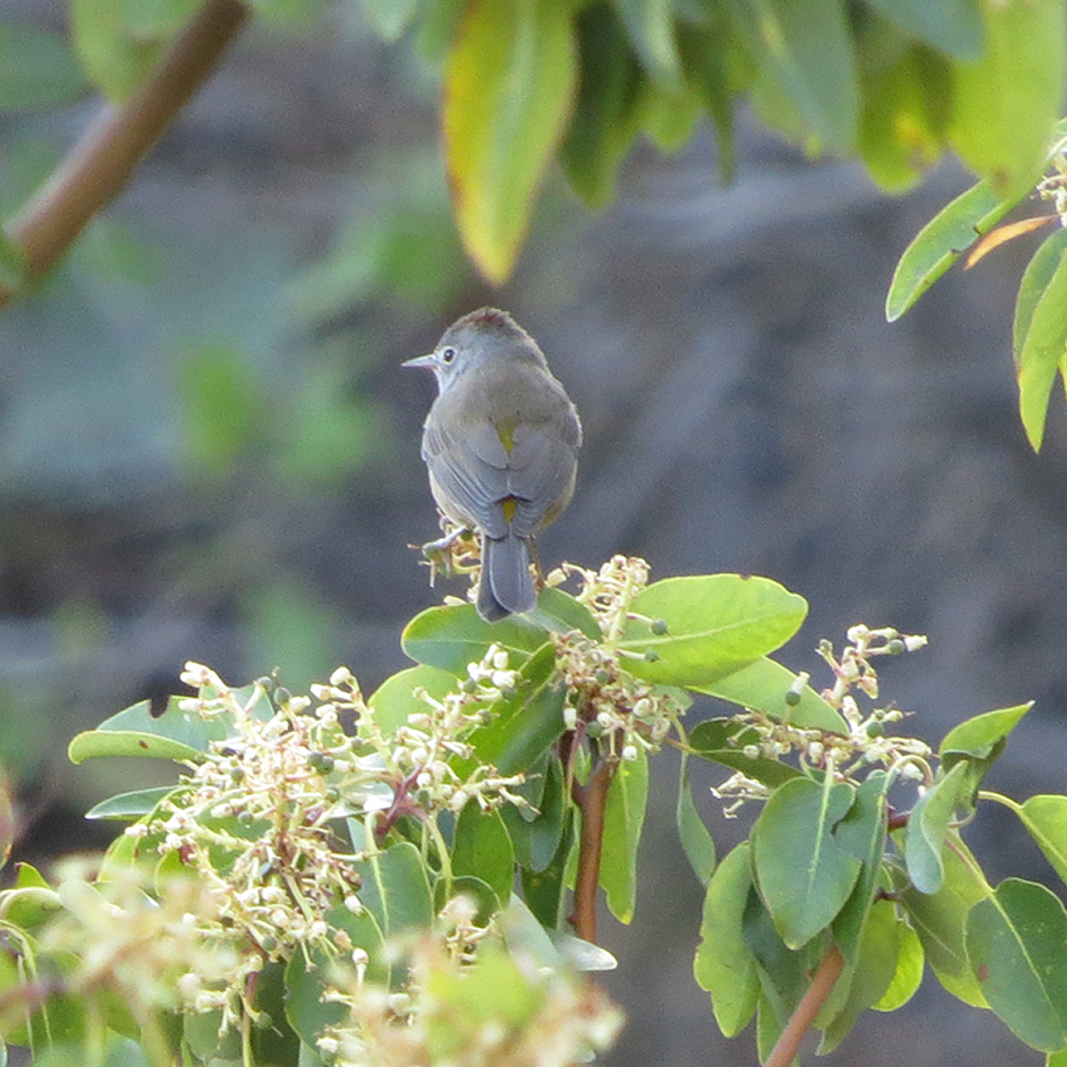
Colima Warbler
Chisos high country only

Vermilion Flycatcher
Cottonwood Campground

Greater Roadrunner
Desert lowlands

Golden-fronted Woodpecker
Riparian corridors

Common Black-Hawk
Rio Grande Village
Stargazing & Night SkyCertified 2012▾
Loading…
Big Bend was certified an International Dark Sky Park in 2012, and NPS describes it as having "the darkest night skies of any national park in the Lower 48." Since 2022, the park anchors the 3.8-million-acre Greater Big Bend International Dark Sky Reserve — the largest certified dark sky place in the world. Best viewing away from Chisos Basin lights, at Rio Grande Village or along the river roads. NPS night sky info ↗
Rio Grande Conditions2 live gauges▾
Rio Grande at Rio Grande Village
Gage HeightLoading…
DischargeLoading…
Updated--
USGS site 08375300 ↗
Park Contact Information