Summary
$20
7-day fee
Historic Crowd Data
Avg. monthly visitors, 2015–2024 · National Park Service
Light
Moderate
Busy
Very Busy
Peak season is May–June, when around 28% of annual visitors arrive. For lighter crowds, aim for November–February.
Plan Your Visit
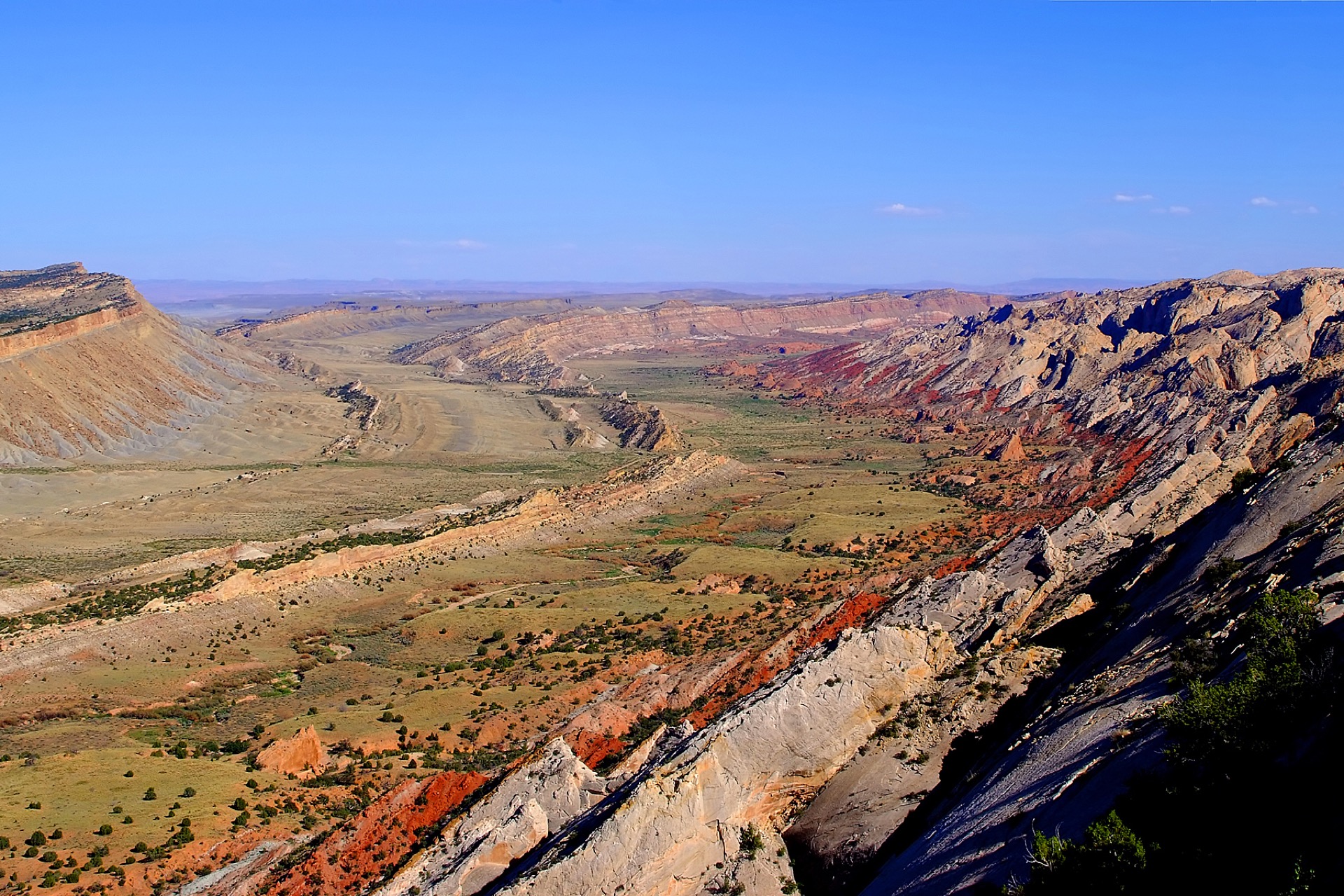
Waterpocket Fold & Backcountry RoadsFlash flood risk▾
Park Entrance & Scenic Drive3 routes · $20▾
Main Access
Open Year-Round
Highway 24, through the park
Unlike most national parks, a public state highway (UT-24) runs right through Capitol Reef, free to drive with no entrance fee required for through-traffic — only the paved Scenic Drive spur requires payment.
💡 Fruita, the historic district with the campground and orchards, sits right off Highway 24.
NPS directions ↗
Scenic Drive
Paved, Year-Round
~8 miles one-way from the visitor center
The only paved road into the park's interior, passing through Grand Wash and Capitol Gorge. Entrance fee required beyond the visitor center.
💡 Can flood and close temporarily during heavy summer monsoon storms.
Scenic Drive info ↗
Cathedral Valley
High-Clearance 4WD Only
Remote northern district
Includes a river-ford crossing of the Fremont River and miles of unpaved road to reach massive sandstone monoliths — no services, no cell signal, and no paved access.
💡 Check the river ford depth at the visitor center before attempting the crossing.
Cathedral Valley info ↗
Campgrounds4 areas▾
Fruita Campground Reservable ▾
Sites71
Price$25/night
SeasonYear-round
NotesSet among the historic orchards; up to 6 months ahead
Book on Recreation.gov ↗
Group Campsite Reservable ▾
Sites1
NotesSecluded, near Fruita Campground; rolling 12-month booking window
Book on Recreation.gov ↗
Cathedral Campground (Primitive) Free, First-Come, First-Served ▾
Sites6
Notes~36 mi from visitor center, ~7,000 ft, no water, high-clearance access
Campground details ↗
Cedar Mesa Campground (Primitive) Free, First-Come, First-Served ▾
Sites5
NotesRemote southern district, no water, check road conditions first
Campground details ↗
Landmarks & Trailheads5 stops▾
Fruita & Scenic Drive3 stops▾
Capitol DomeOverlook only
Roadside · white sandstone dome, the park's namesake
Hickman BridgeModerate
Moderate · natural bridge span
~1.8 mi RT
Cassidy ArchStrenuous
Strenuous · named for outlaw Butch Cassidy
~3.4 mi RT
Backcountry & Remote2 stops▾
Chimney RockModerate
Moderate · isolated red-rock spire
~3.6 mi loop
Cathedral ValleyFull-day trip
4WD · massive sandstone monoliths
Things to Do6 categories▾
Hiking Trails6 trails▾
Grand WashEasy
Flat walk through a narrow wash canyon connecting the Scenic Drive and Highway 24
~4.4 mi RT · 200 ft
Capitol GorgeEasy
Historic wagon route through a narrow canyon, passing the 1871 "Pioneer Register" inscriptions
~2.0 mi RT · 80 ft
Hickman BridgeModerate
One of the park's most popular trails, climbing to a large natural sandstone bridge
~1.8 mi RT · 400 ft
Cohab CanyonModerate
Switchbacks up from Fruita into a hidden side canyon, locally said to be named for polygamists once hiding from federal marshals
~3.4 mi RT · 440 ft
Golden ThroneStrenuous
Climbs to a viewpoint below a massive golden-hued sandstone dome
~4.0 mi RT · 730 ft
Navajo KnobsStrenuous
Ridge-line hike ending at sweeping views over the Fremont River Gorge and Waterpocket Fold
~9.4 mi RT · 1,620 ft
Canyoneering3 options▾
Wife 1 & Wife 2 CanyonsPermit (free)
Technical slot canyons near Fruita with rappels through Navajo Sandstone
Self-Guided CanyoneeringPermit (free)
Free day-use permit required per route, plus a backcountry permit for overnight trips; groups capped at 8
Seasonal Route ClosuresApr 1 – Aug 31
Burro Wash, Fivemile Wash, Shinob Canyon & connected routes, and Arch Nemesis close annually for resource protection
Biking3 ways▾
Scenic Drive7.9 mi paved
Paved road through the park's interior, popular with road cyclists
Cathedral Valley Loop57.6 mi loop
Unpaved high-clearance 4WD route through Cathedral Valley with a Fremont River ford; long and very strenuous
Where Bikes Are AllowedRoads only
Roads only, plus the paved path between the visitor center and Fruita Campground; not permitted on hiking trails, washes, or backcountry routes
Petroglyphs & Historic Sites3 stops▾
Capitol Reef Petroglyph Panel1.1 mi E of visitor center
Fremont Culture rock art with bighorn sheep & human figures, viewed from roadside boardwalks along Hwy 24
Behunin CabinOn Hwy 24
1883 sandstone pioneer cabin built by Elijah Behunin for his family of 15; the park's most intact settler cabin
Fruita SchoolhouseScenic Drive
One-room schoolhouse used by the Fruita community 1896–1941, restored to its 1930s appearance
Stargazing & Night SkyExcellent, informal▾
Loading…
Capitol Reef's remote location, far from major cities, makes for excellent dark skies across the entire park — especially in Cathedral Valley, away from even the modest lights of Fruita. Best on new-moon nights. Bring warm layers — high-desert nights cool quickly after sunset. NPS plan-your-visit info ↗
Bird WatchingTop 5 species▾

California Condor
Rare visitor to the Fold

Golden Eagle
Nests on Waterpocket Fold cliffs

Peregrine Falcon
Hunts along canyon walls

White-throated Swift
Fast flier over sandstone cliffs

American Dipper
Forages in the Fremont River
River Conditions1 live gauge▾
Fremont River at Hwy 24 (near Caineville)
FlowLoading…
Gauge HeightLoading…
Historic Orchards & Concessions1 location▾
Gifford Homestead1 location▾
Gifford House StoreSeasonal
Pies · Gifts · Pioneer-era goods
Park Contact Information