Summary
$10/person
Entry fee
1 live
Camera
--
Campgrounds
Historic Crowd Data
Avg. monthly visitors, 2015–2024 · National Park Service
Light
Moderate
Busy
Very Busy
Peak season is March, when around 15% of annual visitors arrive. For lighter crowds, aim for June–September.
Plan Your Visit
Extreme Wind SafetyDedicated wind page▾
Park Entrance & FeesPine Springs · $10/person▾
Main Entrance
Usually Open
Pine Springs, via US-62/180
The park's main hub — visitor center, Guadalupe Peak & Devil's Hall trailheads, and Pine Springs Campground, roughly 55 miles southwest of Carlsbad, NM.
💡 Despite being in Texas, the park runs on Mountain Time, not Central — a genuine and easy-to-miss quirk. Cell service is unreliable throughout.
NPS directions ↗
Note
Unusual Fee Model
Per-person, not per-vehicle
Unlike most national parks, Guadalupe Mountains charges $10 per person (16+) rather than a flat vehicle rate — no separate motorcycle or vehicle fee tier.
NPS fee details ↗
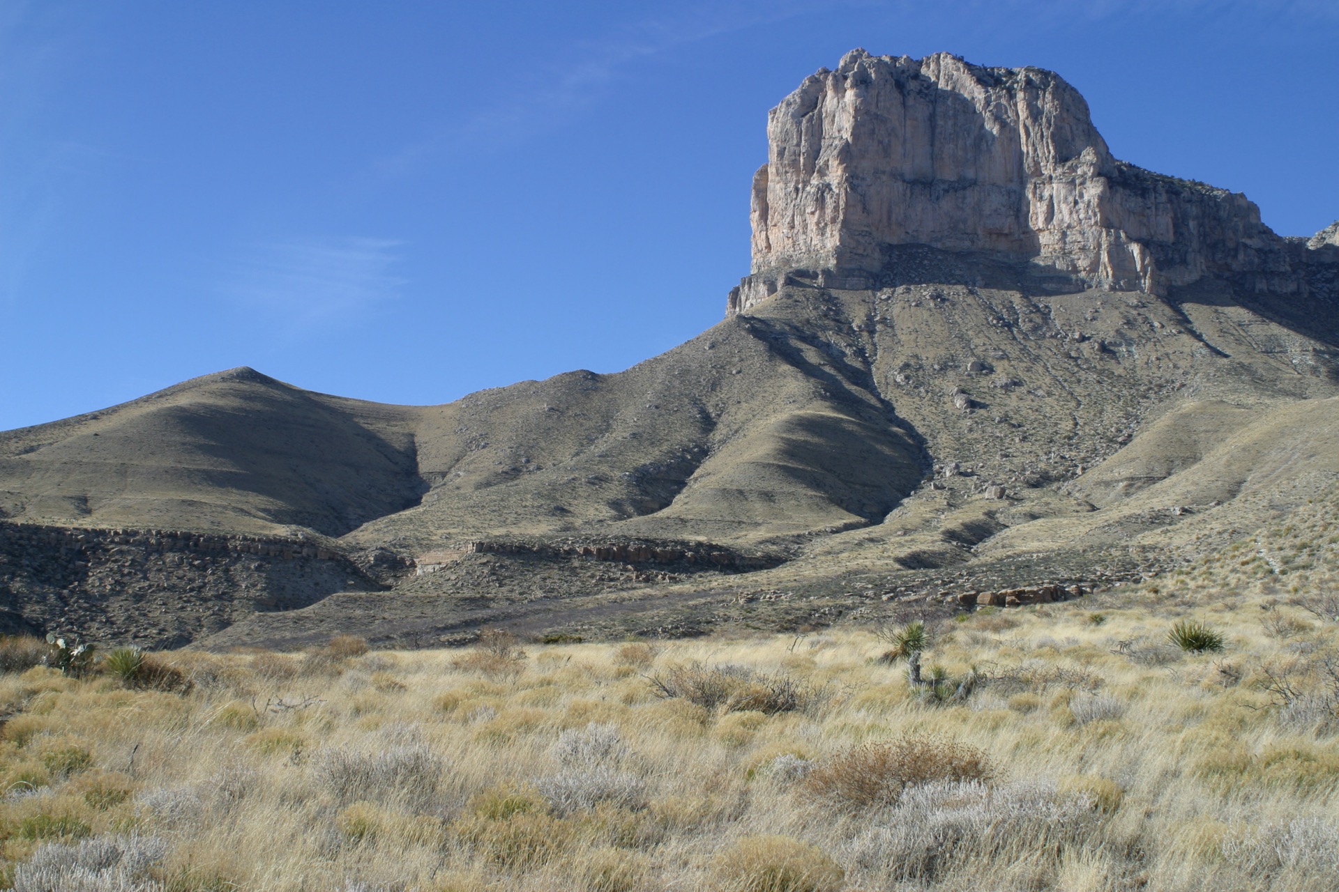
Guadalupe Peak & El Capitan8,751 ft▾
Guadalupe Peak Trail Strenuous · Full Day ▾
Summit8,751 ft — highest point in Texas
Distance8.4 mi round trip
Elevation Gain~3,000 ft
Time6–10 hrs, no water on trail
El Capitan Roadside Landmark ▾
Elevation8,085 ft
NotesA distinct peak from Guadalupe Peak, forming the dramatic cliff face visible from US-62/180
McKittrick CanyonGate 8am–5pm▾
Campground Availability2 areas▾
Pine Springs Campground Reservation Only ▾
Sites~35 (20 tent, 13 RV, 2 group)
LocationAt the main Pine Springs entrance/trailhead
Book on Recreation.gov ↗
Dog Canyon Campground Reservation Only ▾
Sites~14 (9 tent, 4 RV, 1 group)
AccessRemote — reached via New Mexico, NOT from Pine Springs directly
Notes6,300 ft elevation, cooler & far quieter than Pine Springs
Landmarks & Trails3 stops▾
Pine Springs Area2 stops▾
Devil's Hall Trail3–5 hrs
4.2 mi round trip, ~548 ft gain · rock-scrambling in a wash to a narrow limestone slot — dangerous when wet
Frijole Ranch History Museum~1 hr
~1.5 mi from the Visitor Center · historic ranch buildings & picnic area
Remote / Detached Unit1 stop▾
Salt Basin DunesDay-use only
Detached gypsum-dune unit on the park's remote west side · day-use only, sunrise–30 min after sunset · access road turns dangerously slippery when wet · no camping
Things to Do6 categories▾
Hiking Trails6 trails▾
Smith Spring Trail2.3 mi RT
Short loop past a spring-fed oasis of maples and madrones; a popular short fall-color walk near Frijole Ranch
McKittrick Canyon TrailUp to 10.9 mi one-way
Follows the canyon past Pratt Cabin toward the Grotto and on to McKittrick Ridge, the park's signature fall-foliage corridor
The Bowl Trail3.6 mi RT
Steep climb onto the high plateau into a relict ponderosa & Douglas-fir forest atop the range
Tejas Trail11.8 mi one-way
High-country connector between Pine Springs and Dog Canyon; a common backpacking thru-route
Bush Mountain Trail12.3 mi one-way
Traverses the range's second-highest peak, linking Pine Top to Dog Canyon
El Capitan Trail9.4 mi one-way
Skirts the base of the range's iconic cliff face en route to the historic Williams Ranch
Backcountry Camping & Permits2 items▾
Wilderness Use Permit$6 + $6/person/night
Required year-round for any overnight backcountry stay; walk-up issued at Pine Springs Visitor Center 8 AM–noon daily, or reserve on Recreation.gov up to 3 months ahead
Designated Wilderness Campgrounds10 campgrounds
10 designated backcountry campgrounds spread across the range, including McKittrick Ridge; max stay 7 nights, up to 4 people per site
Horseback Riding & Stock Use2 items▾
Trail Access for StockDay-use only
About 60% of park trails allow horses/pack animals for day use, including El Capitan, Tejas & Bush Mountain trails; the Guadalupe Peak Trail is closed to stock
Frijole Horse CorralPermit required (free)
Staging area with 4 corrals, hitching posts, water troughs & extra trailer parking; bring your own stock — none available for hire in or near the park
Historic Sites1 stop▾
The PineryEasy
Paved, wheelchair-accessible path from Pine Springs Visitor Center to the ruins of an 1858 Butterfield Overland Mail relay station — the highest stop on the 2,800-mile route
0.75 mi RT
Stargazing & Night SkyNot yet certified▾
Loading…
Guadalupe Mountains does not currently hold a confirmed International Dark Sky Park designation, but its remote location far from any city, high desert elevation, and dry air make for exceptional, largely light-pollution-free night skies. NPS night sky info ↗
Bird WatchingTop 5 species▾

Golden Eagle
Soars above the highest peak in Texas

Greater Roadrunner
Common on desert trails

Peregrine Falcon
Nests on the high cliffs

Canyon Wren
Echoing song in McKittrick Canyon
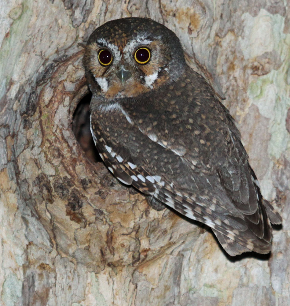
Elf Owl
World's smallest owl species
Park Contact Information