Summary
2/3
Entrances open
$30
7-day fee
1 live
Camera
--
Campgrounds
Historic Crowd Data
Avg. monthly visitors, 2015–2024 · National Park Service
Light
Moderate
Busy
Very Busy
Peak season is July, when around 24% of annual visitors arrive. For lighter crowds, aim for November–May.
Plan Your Visit
Geothermal Hazard SafetyActive volcano▾
Park Entrances & Fees2 open · $30▾
NW Entrance
Usually Open
SR-89, via Manzanita Lake / Hwy 44 & 89 junction
Closest entrance to Manzanita Lake, the largest campground, and the north end of the Main Park Road. Common approach from Redding.
💡 Main Park Road closes in winter — confirm it's open before planning a drive-through trip.
NPS directions ↗
SW Entrance
Usually Open
SR-89, via Kohm Yah-mah-nee Visitor Center / Sulphur Works
Main visitor hub with the year-round visitor center, closest access to Bumpass Hell trailhead and Sulphur Works. Common approach from Red Bluff / Chico.
💡 The Kohm Yah-mah-nee Visitor Center stays open even when the Main Park Road beyond it is snowed in.
NPS directions ↗
NE Entrance
Seasonal / Gravel
Butte Lake Road, via Hwy 44
Remote gravel-road access to Butte Lake, Cinder Cone & the Fantastic Lava Beds — not connected to the Main Park Road corridor.
💡 No live wait-time data exists for any Lassen entrance — none are gated/metered like larger parks.
NPS directions ↗
Campground Availability3 open · 1 closed▾
Manzanita Lake Reservation Only ▾
Sites179
Elevation~5,900 ft
AmenitiesFlush toilets, camp store
NotesLargest & most family-friendly campground · near the NW entrance
Book on Recreation.gov ↗
Summit Lake (South) Reservation Only ▾
Sites~48
Elevation6,700 ft
NotesNear the lakeshore, central along the Main Park Road
Book on Recreation.gov ↗
Butte Lake Reservation Only ▾
Sites101
ElevationRemote NE corner
NotesNo-generator policy · good dark skies, popular for astrophotography
Book on Recreation.gov ↗
Juniper Lake Closed ▾
StatusClosed · no confirmed 2026 reopening date
Sites (normally)18 first-come + 2 group sites
Elevation6,800 ft
NotesRemote SE corner · do not plan a trip around this campground being open
Campground details ↗
Things to Do6 categories▾
Hiking Trails6 trails▾
Manzanita Lake LoopEasy
Easy, mostly-flat loop around the lake with scenic Lassen Peak views and wildlife watching
1.7 mi loop
Bumpass Hell TrailEasy–Mod.
Boardwalk trail to the park's largest hydrothermal basin; stay on the boardwalk past the overlook
3 mi RT · ~2 hrs
Kings Creek Falls2.3 mi loop · 486 ft · ~2 hrs
Loop past a 30-ft waterfall; gradual descent along Upper Cascades, steep stone-staircase return via Cascades Foot Trail
Cinder Cone TrailChallenging
Steep climb up loose volcanic cinders to the rim of a symmetrical cinder cone; remote Butte Lake trailhead, ~24 mi from Manzanita Lake
4 mi RT · 846 ft
Brokeoff MountainStrenuous
The park's longest maintained day hike, climbing the eroded remnant of ancient Mount Tehama to sweeping summit views
7.4 mi RT
Lassen Peak Trail5 mi RT · 1,957 ft · Jul–Oct
Switchbacks up cinders and rocky ridge to the summit of one of the world's largest plug dome volcanoes; closes for snow most of the year
Fishing2 ways▾
Manzanita LakeCA license req.
Park's most popular fly-fishing water; catch-and-release only, single barbless hook, artificial lures/flies only — no live or dead bait
Backcountry Lakes & StreamsCA license req.
Butte, Snag, Horseshoe, Ridge, Terrace, Summit & Crystal Lakes plus Kings & Grassy Swale Creeks hold rainbow, brown & brook trout
Boating4 lakes▾
Manzanita Lake Kayak RentalsLate May–Sep
Kayaks & life vests rented at the Camper Store, 10am–4pm; designated launch required
Butte, Juniper & Summit LakesNon-motorized only
Self-supported non-motorized boating (engines of any type prohibited); Coast Guard-approved life jacket required per person
Winter Sports2 areas▾
Manzanita Lake AreaNov–May
Gentler terrain (5,800–7,200 ft) with the park's easiest snowshoeing & cross-country ski routes
Southwest AreaNov–May
Steeper terrain and broad mountain views (6,700–10,457 ft) beyond Kohm Yah-mah-nee Visitor Center — the only park services open in winter
Stargazing & Night SkyNo IDA designation▾
Loading…
Lassen Volcanic does not hold a formal DarkSky International (IDA) dark sky designation, but its remoteness and minimal light pollution make for excellent night skies. Butte Lake, in the park's isolated NE corner, is informally popular with astrophotographers thanks to its distance from any light source and its no-generator campground policy. Best on new-moon nights — bring a red flashlight to preserve night vision and layer up, as high-elevation nights get cold fast. NPS night sky info ↗
Bird WatchingTop 5 species▾

Golden Eagle
Soars over the volcanic terrain

Osprey
Fishes the park's lakes

American Dipper
Forages in cold mountain streams

Steller's Jay
Photographed at the visitor center

Clark's Nutcracker
High-elevation conifer forests
Concession Information4 locations▾
Kohm Yah-mah-nee Visitor Center (SW)2 locations▾
Lassen Cafe & GiftYear-round
Light fare, coffee & souvenirs · run by park partner
Lassen Association BookstoreYear-round
Trail guides, maps & books · nonprofit park partner
Manzanita Lake (NW)2 locations▾
Manzanita Lake Camper StoreSeasonal · mid-May–mid-Oct
Groceries, camping supplies, gifts & the only gas sold in the park
Lassen Association Store — Loomis PlazaSeasonal
Educational books & maps · at the Loomis Museum
Landmarks5 stops▾
Hydrothermal Areas2 stops▾
Bumpass HellStay on boardwalk
Largest hydrothermal basin in the park · ~3 mi RT boardwalk trail, 8,200–8,400 ft · opens roughly early July–October depending on snowmelt
Sulphur WorksStay on trail
Paved, wheelchair-accessible · roadside steam vents & mud pots near SW entrance
Peaks & Volcanic Features2 stops▾
Lassen Peak Trail~4–5 hrs RT
Strenuous summit trail · 10,457 ft, one of the world's largest plug dome volcanoes
Cinder Cone~4–5 hrs RT
Strenuous · NE corner near Butte Lake, volcanic cinder cone with summit views
Lakes & Visitor Hub1 stop▾
Manzanita LakeEasy access
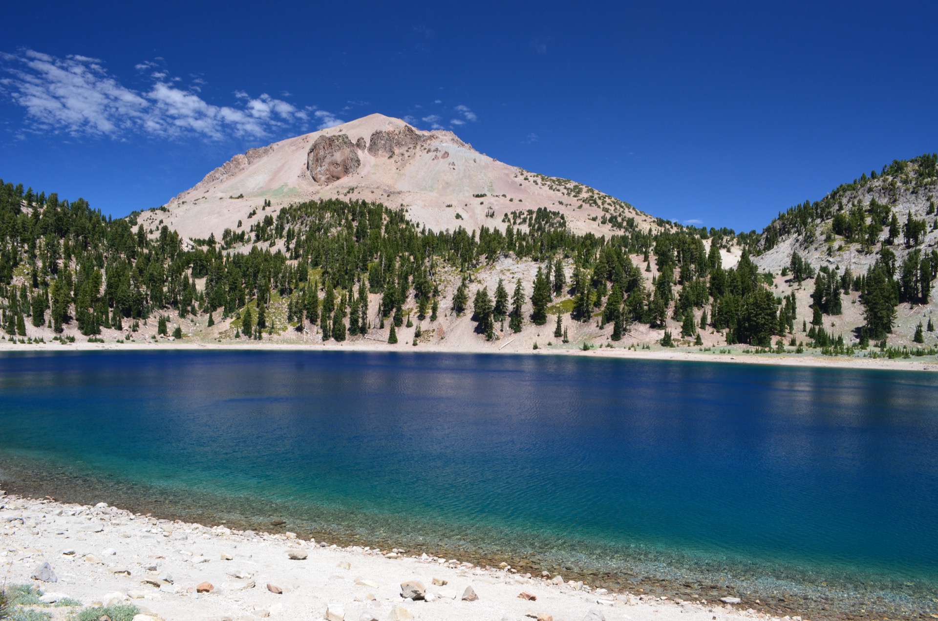
Camping, kayaking & canoeing · classic reflective views of Lassen Peak
Park Contact Information