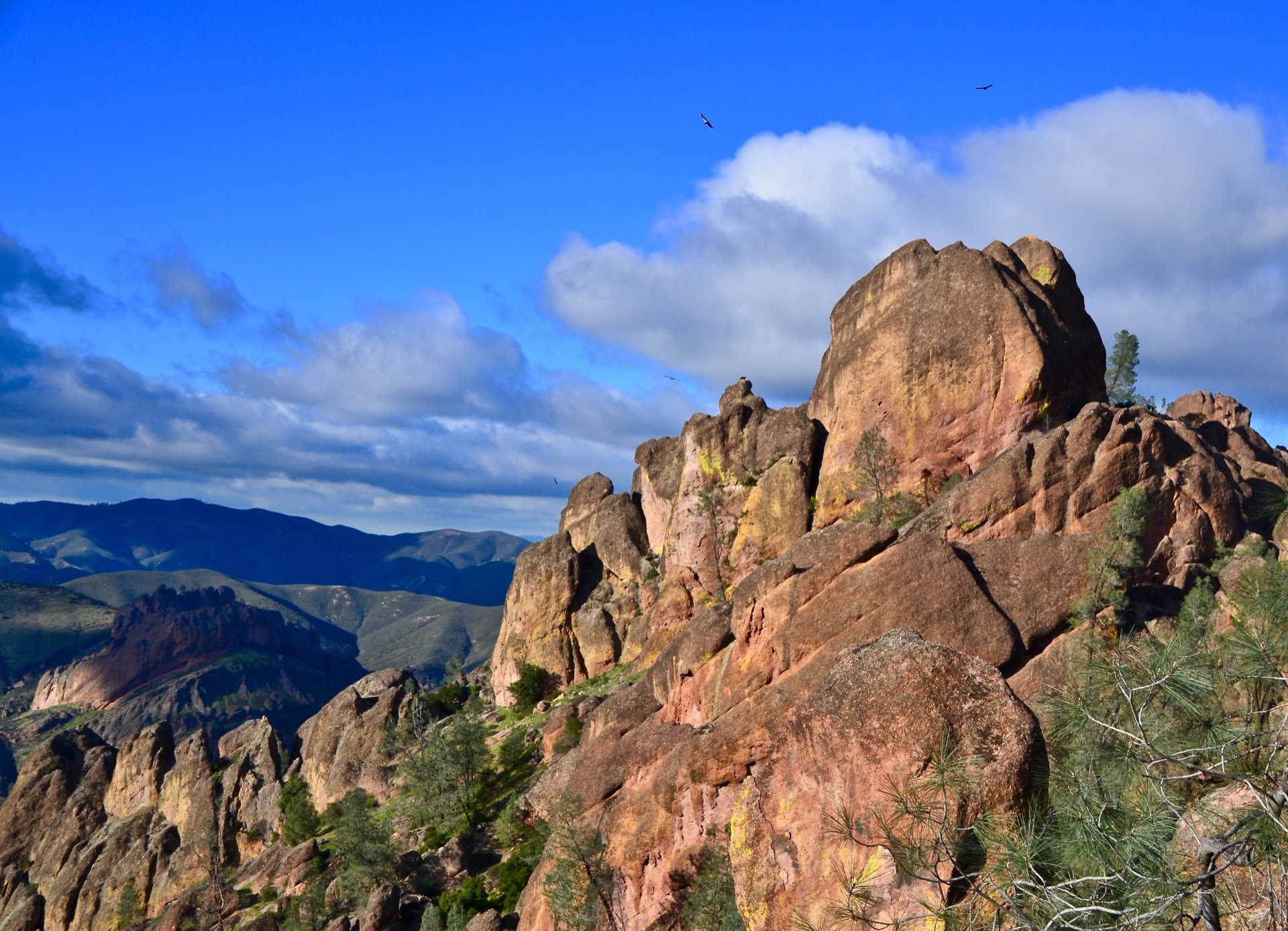
Summary
Don't connect
Two entrances
$30
7-day fee
Historic Crowd Data
Avg. monthly visitors, 2015–2024 · National Park Service
Light
Moderate
Busy
Very Busy
Peak season is March–May, when around 33% of annual visitors arrive. For lighter crowds, aim for August–October.
Plan Your Visit
Two Entrances — They Do NOT ConnectNo connecting road▾
East Entrance
Open 24 Hours
Via Hwy 25 south of Hollister, then Hwy 146 west
Has the Visitor Center, the only campground, and Bear Gulch Cave. The fuller-featured side of the park — most visitors should start here.
💡 This is the only side with camping and staffed visitor services.
NPS directions ↗
West Entrance
Day Use Only
Via US-101 near Soledad, then Hwy 146 east
Reaches the Chaparral area and Balconies Cave. No campground on this side, and the road in is narrow and winding — no RVs or trailers.
💡 Small parking lot at Chaparral fills early on weekends.
NPS directions ↗
Cave Status1 of 2 closed▾
Bear Gulch Cave
Closed
East side. Both the upper and lower sections are closed for Townsend's big-eared bat maternity/pupping season, typically mid-May through mid-July. The upper section often stays closed most of the year regardless of season to protect the roost.
Balconies Cave
Open
West side, Chaparral area. Home to Western mastiff bats. Also subject to sudden flood closures after heavy rain — check conditions if rain is recent.
Campground134 sites▾
Pinnacles Campground Reservation Recommended ▾
Sites134 (36 w/ electric hookups)
Elevation~1,300 ft
SeasonYear-round
RV LengthUp to 42 ft on some sites
AmenitiesFlush toilets, showers, camp store, seasonal pool (Apr–Sep)
Book on Recreation.gov ↗
Concession Information2 locations▾
East Side — Pinnacles Campground1 location▾
Pinnacles Park StoreDaily 9am–4pm
Books, souvenirs, water & camp basics · run by Western National Parks Association
West Side — Chaparral Area1 location▾
West Pinnacles Visitor Contact Station StoreDaily 9am–3pm
Small WNPA store · books, souvenirs & safety essentials — no food service
Landmarks & Trails5 stops▾
East Side3 stops▾
High Peaks Trail~4–5 hrs
Strenuous · 6 mi loop w/ Condor Gulch · steep, exposed spires
Bear Gulch Cave & Reservoir~1.5 hrs
Moderate · talus cave, see cave status above
Condor Viewing — Juniper Canyon Jct.Varies
Best viewpoint atop the High Peaks switchbacks
West Side — Chaparral Area2 stops▾
Balconies Cave~1–2 hrs
Moderate · talus cave, see cave status above
Rock Climbing RoutesVaries
Volcanic breccia routes · raptor nesting closures Jan–Jul in some areas
Things to Do4 categories▾
Hiking Trails7 trails▾
Moses Spring to Rim Trail LoopModerate
Short loop past Bear Gulch Reservoir and the talus-cave rock formations, east side
2.2 mi RT · 500 ft
Condor Gulch to High Peaks LoopStrenuous
Panoramic High Peaks views with condor-viewing opportunities along a steep, narrow corridor
5.3 mi RT · 1,300 ft
High Peaks to Bear Gulch LoopStrenuous
Classic loop connecting the High Peaks spires with Bear Gulch Reservoir; wildflowers in spring
6.7 mi RT · 1,425 ft
Old Pinnacles Trail to Balconies CaveModerate
Popular east-side approach past the Machete Ridge rock formations; flashlight needed in the cave
5.3 mi RT
Balconies Cliffs–Cave LoopEasy–Mod.
West-side loop featuring Balconies Cave exploration
2.4 mi RT · 100 ft
Juniper Canyon LoopStrenuous
Switchback climb from Chaparral to the High Peaks; the primary west-side approach
4.3 mi RT · 1,215 ft
Chalone Peak TrailStrenuous
Longest maintained trail in the park, climbing to the park's high point
9 mi RT · 2,040 ft
Rock Climbing4 notes▾
Named Climbing AreasVolcanic breccia
The Balconies, Elephant Rock, Chockstone Dome & Machete Ridge — accessed from the Chaparral parking area on the west side
Route TypesYear-round
Toprope routes suit beginners; multi-pitch routes on formations like Machete Ridge challenge experienced climbers. Rock is notably weak — helmets required
Raptor Nesting ClosuresJan–Jul (some areas)
Sensitive climbing areas close seasonally to protect nesting peregrine & prairie falcons; check current advisories before climbing
Guides & FeesNo climbing fee
No separate climbing permit needed; hired guides must hold an NPS-issued guiding permit. Standard park entrance fee applies
Stargazing & Night SkyGold tier▾
Loading…
Pinnacles is a certified Gold-Tier International Dark Sky Park — the highest official designation for night sky quality, confirmed by DarkSky International. Best Milky Way viewing runs roughly February through October, and the park runs ranger-led stargazing programs seasonally. Best on new-moon nights — bring a red flashlight to preserve night vision. NPS night sky info ↗
Bird Watching159+ species▾

California Condor
Reintroduced here since 2003, the park's signature species

Golden Eagle
Nests on the high rock formations
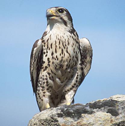
Prairie Falcon
Hunts over the talus and high peaks

Peregrine Falcon
Seasonal climbing closures protect nesting pairs

Turkey Vulture
Common overhead, easily confused with condors at a distance
Park Contact Information