Summary
$30
7-day fee
--
Campgrounds
Historic Crowd Data
Avg. monthly visitors, 2015–2024 · National Park Service
Light
Moderate
Busy
Very Busy
Peak season is June–September, when around 60% of annual visitors arrive. For lighter crowds, aim for November–April.
Plan Your Visit
Rim Edge & Altitude SafetyNo guardrails▾
South Rim Fire Recovery2025 fire impact▾
Park Access & FeesSouth Rim 24/7 · $30▾
South Rim
Open 24/7 Year-Round
Paved access via CO-347, from Montrose
The main, most-visited side — paved road, the Visitor Center, South Rim Road overlooks, and (reduced-capacity) South Rim Campground.
💡 Open around the clock, every day of the year — no seasonal closure on this side.
NPS directions ↗
North Rim
Seasonal · Gravel
Unpaved gravel road, via CO-92 near Crawford
The last 7 miles of the access road and all of North Rim Drive are unpaved. Road and ranger station typically close mid-November, reopening early May.
💡 No road connects the two rims inside the park — driving between them takes 2+ hours around via public highways.
NPS directions ↗
Campground AvailabilityReduced capacity▾
South Rim Campground Reduced for 2026 ▾
Open Sites25 non-electric (of 88 normal)
SeasonMay 18–Sept 30, 2026
Fee$20/night
NotesCapacity cut due to 2025 South Rim Fire damage & ongoing rehab
Book on Recreation.gov ↗
North Rim Campground First-Come, First-Served ▾
Sites13
Fee$20/night, Scan & Pay via Recreation.gov app (cashless)
NotesNo fire impact; seasonal with the North Rim Road
Landmarks & Overlooks7 stops▾
South Rim Road4 stops▾
Gunnison Point~10 min
Right at the South Rim Visitor Center
Chasm View~15 min
One of the narrowest, most dramatic overlooks
Painted Wall View~15 min
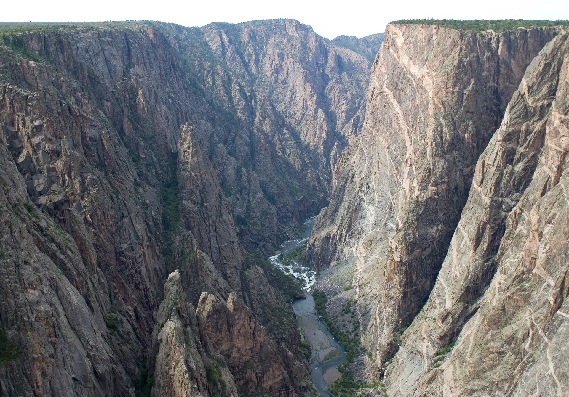
View of Colorado's tallest cliff, 2,250 ft river-to-rim
Warner Point Trail~1 hr
1.5 mi round trip to the highest South Rim viewpoint · open, no fire impact
North Rim2 stops▾
North Rim Chasm View~10 min
A different angle on the same narrow gorge as the South Rim's Chasm View
Kneeling Camel View~10 min
Named for a distinctive rock formation across the canyon
Inner Canyon — Wilderness Routes1 stop▾
Gunnison Route & other inner-canyon routesFull day+
Primitive, unmarked, very strenuous — $6 wilderness permit required via Recreation.gov, Gunnison Route capped at 15 people/day. Not for casual hikers.
Things to Do6 categories▾
Hiking Trails6 trails▾
Uplands TrailModerate
South Rim · links Rim Rock Trail near the campground to Oak Flat Trail near the Visitor Center
.9 mi
Rim Rock TrailModerate
South Rim · rocky path with stairs connecting South Rim Campground and the Visitor Center
1 mi
Oak Flat TrailStrenuous
South Rim · loop below the rim through aspen and Gambel oak
1.6 mi RT
Chasm View TrailEasy
North Rim · short walk from North Rim Campground to a dramatic overlook
.3 mi
Deadhorse TrailModerate
North Rim · old road to a former uranium prospect site above the canyon; loop option goes farther
2.6–6.6 mi RT
North Vista TrailModerate
North Rim · ridge walk to Exclamation Point, continuing to the summit of Green Mountain
1.6–3.6 mi
Backcountry Descent Routes6 routes▾
Gunnison Route1.5 mi · 1,800 ft loss
South Rim · recommended for a first inner-canyon descent, still very strenuous
Tomichi Route1 mi · 1,960 ft loss
South Rim · the steepest South Rim route
Warner Route2.75 mi · 2,722 ft loss
South Rim · longest South Rim route; overnight travel highly suggested
Pinyon Draw (S.O.B. Draw)1.75 mi · 1,800 ft loss
North Rim · suggested for a first North Rim descent; 6 designated campsites
Long Draw (Devil's Slide)1 mi · 1,800 ft loss
North Rim · 8–12 ft ledges to climb, including one near-vertical section
Slide Draw1 mi · 1,620 ft loss
North Rim · the most challenging and hazardous route, extremely steep with loose rock
Rock Climbing2 things to know▾
North & South Chasm Walls145 routes · 5.8–5.13
145 routes on the canyon's namesake walls, including the 2,250-ft Painted Wall (Colorado's tallest cliff); free wilderness permit & clean-climbing gear required, not recommended for beginners
Raptor Nesting ClosuresMar 15–Jul 15
Select routes close annually to protect nesting raptors
Fishing the Gunnison River4 things to know▾
Gunnison RiverLicense req.
Gold Medal & Wild Trout Water below the dams; Colorado fishing license required, artificial flies or lures only — no bait
Rainbow TroutCatch & release
Catch-and-release only, park-wide
Brown Trout4 daily · 8 poss.
May be kept within daily & possession limits
East Portal Road16% grade
Steep access route down to the river; max vehicle length 22 ft including trailers; closes in winter
Stargazing & Night SkyCertified 2015▾
Loading…
Black Canyon of the Gunnison was designated an International Dark Sky Park on September 8, 2015. The canyon's dramatic depth and remote high-elevation setting make South Rim and North Rim overlooks excellent viewing spots, far from city lights. NPS night sky info ↗
Bird WatchingTop 5 species▾

Gunnison Sage-Grouse
Found nowhere else in the US

Golden Eagle
Soaring over the canyon

Peregrine Falcon
Nests on canyon cliffs

White-throated Swift
Circles above the rim

American Dipper
Along the Gunnison River
Gunnison River Conditions1 live gauge▾
Gunnison River below Gunnison Tunnel (East Portal)
Gage HeightLoading…
DischargeLoading…
Updated--
USGS site 09128000 ↗
Park Contact Information