Summary
8 miles
Scenic drive
Free
Entry
--
Campground
Historic Crowd Data
Avg. monthly visitors, 2015–2024 · National Park Service
Light
Moderate
Busy
Very Busy
Peak season is February–April, when around 42% of annual visitors arrive, with March the busiest month. For lighter crowds, aim for June–September (the park is often cooler than Arizona's cities, with summer highs in the 80s and 90s; winter lows are often near or below freezing).
Plan Your Visit
Roads, Hours & FeesFree entry▾
Bonita Canyon Scenic Drive
Check alerts
8 miles from the entrance to Massai Point
The only road in the park. The road, campground and facilities are open overnight and the gates are not closed unless there is an emergency. Speed limit is 25–40 mph; without stops the drive takes about 30 minutes to the top.
💡 High winds and fallen trees can close the road. Open the NPS alerts card above for the current status.
NPS directions ↗
Visitor Center
8:30 am – 4:30 pm
2 miles past the entrance, on the right
Information desk, museum, park film and store. Hours are in Mountain Standard Time, and most of Arizona does not observe daylight saving time. Closed Thanksgiving, Christmas and New Year's Day.
💡 Free maps and Junior Ranger booklets are handed out in person; the park no longer mails materials.
NPS hours ↗
Campground23 sites▾
Bonita Canyon Campground Reservation Required ▾
Sites23 drive-in sites (1 group site)
Fee$25 per site · $50 group site #26 (tents only)
Vehicle limit29 ft total, trailers included (a dip in the road damages longer rigs)
AmenitiesFlush toilets, drinking water, picnic tables, food-storage lockers
Not availableNo hookups, showers, ground fires or dump station · no cell service or internet
Check-inAfter noon · check out by 11 am · quiet hours 8 pm–8 am
Book on Recreation.gov ↗
Services & Supplies1 location▾
Visitor Center1 location▾
Chiricahua Visitor Center & Park StoreDaily 8:30am–4:30pm
Shirts, books, stickers and other collectibles · cashless, so bring a card or mobile pay
Landmarks4 stops▾
Along Bonita Canyon Drive2 stops▾
Faraway Ranch Historic District1 mi from entrance
Historic ranch that preserves a story important to women's history and to the history of the monument; picnic area with drinking water and flush toilets
Massai Point OverlookEnd of the drive
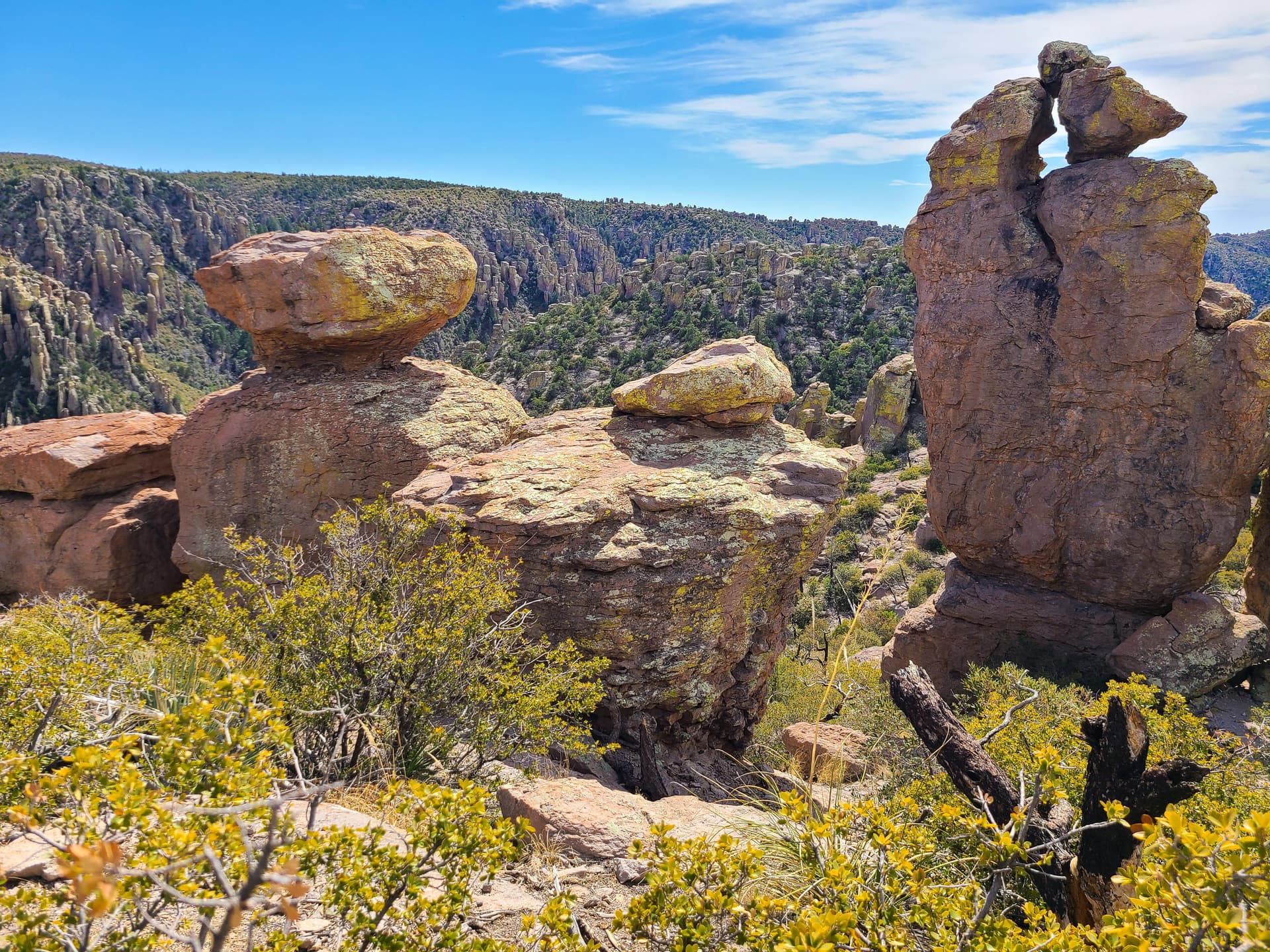
6,870 ft · 360° views of the Wonderland of Rocks and the surrounding valleys and mountains, plus a half-mile nature trail past balanced rocks to an exhibit building
Heart of Rocks2 stops▾
Big Balanced Rock7.3+ mi round trip
One of the monument's most famous rocks, near the Heart of Rocks Loop · a strenuous hike, so carry plenty of food, water and a map
Pinnacle Balanced Rock7.3+ mi round trip
Another of the best-known balanced rocks, on the Heart of Rocks Loop · pets are not allowed
Things to Do5 categories▾
Hiking Trails9 trails▾
Massai Point Nature TrailShort
Half-mile loop through balanced rocks from the top of the scenic drive (6,870 ft); uneven footing and stairs can make it feel harder than it looks
0.5 mi loop · ~30 min
Echo Canyon GrottoesShort
Tunnel-like rock formations half a mile from the Echo Canyon parking area; a good option with limited time or mobility
~0.5 mi one way · 30–60 min
Silver Spur Meadow TrailLeisurely
Leisurely walk past Faraway Ranch, Stafford Cabin and Silver Spur Meadow · leashed dogs welcome
1.2 mi · 45–90 min
Sugarloaf Mountain TrailModerate
Climbs to a 7,310 ft summit, one of the monument's highest points, with a fire lookout on top
1.8 mi RT · 1–2 hrs
Lower Rhyolite Canyon TrailMostly level
Mostly level walk into a canyon lined with rock pinnacles, to the Upper Rhyolite Canyon and Sarah Deming trail junction; return the same way
~3 mi RT (1.5 mi each way)
Echo Canyon Loop TrailModerate
The park's most impressive moderate hike: balancing rocks, tunnel-like grottoes, narrow slots and towering pinnacles
3.3 mi · 2–4 hrs
Inspiration Point TrailStrenuous
Ed Riggs, Mushroom Rock and Inspiration Point trails to an overlook toward Cochise Head and Rhyolite Canyon
5.4 mi · 3–4 hrs
Heart of Rocks LoopStrenuous
The way to Big Balanced Rock, Pinnacle Balanced Rock and many of the monument's most unusual formations; lots of rock steps. Hike clockwise for the best views
7.3 mi RT · 4–6 hrs
The Big LoopFull day
Echo Canyon, Upper Rhyolite Canyon, Sarah Deming, Heart of Rocks, Big Balanced Rock, Inspiration Point, Mushroom Rock and Ed Riggs trails in one route
9.5 mi · 4–7 hrs
Stargazing & Night SkyInternational Dark Sky Park▾
Loading…
Chiricahua is an International Dark Sky Park. The trails stay open for sunrise, sunset and night-sky viewing, and the best spots are the Faraway Ranch and Echo Canyon parking lots, which have wide, unobstructed views. Skip the full moon for the best views, and watch for wildlife on the road and trails after dark. The park prohibits overnight parking and sleeping in vehicles outside the campground. NPS night sky info ↗
Bird Watching200+ species▾

Mexican Jay
Frequently seen here (NPS)

Acorn Woodpecker
Frequently seen here (NPS)

Canyon Wren
Frequently seen here (NPS)

White-breasted Nuthatch
Frequently seen here (NPS)

Yellow-eyed Junco
Frequently seen here (NPS)
Photos via Wikimedia Commons: Mexican Jay (NBII, public domain); Acorn Woodpecker by Sarah Stierch (CC BY 4.0); Canyon Wren by Hovenweep National Monument (CC BY 2.0); White-breasted Nuthatch by Cephas (CC BY-SA 3.0); Yellow-eyed Junco by 666isMONEY (CC BY 2.0). "Frequently seen" species per the National Park Service.
Horseback Riding & Picnics4 notes▾
Horseback RidingMany trails
Horses are allowed on many trails; parties are limited to 10 animals at a time and 20 per day, and stock stays on developed trails
Closed to StockFour trails
Stock is not permitted on the Massai Nature Trail, Heart of Rocks Loop, Natural Bridge or Sugarloaf Mountain trails, or on paved roads except at crosswalks
Picnic Areas3 areas
Bonita Creek, Faraway Ranch and Massai Point have accessible tables, some covered; picnic areas have no grills or fire facilities
Restrooms & WaterFaraway & Visitor Center
Drinking water and flush toilets at Faraway Ranch and the Visitor Center; every parking lot has restrooms and trash cans
Park Contact Information